Swims from Far Bank End Farm
Introduction
The photograph on this page of Swims from Far Bank End Farm by John Aspden as part of the Geograph project.
The Geograph project started in 2005 with the aim of publishing, organising and preserving representative images for every square kilometre of Great Britain, Ireland and the Isle of Man.

There are currently over 7.5m images from over 14,400 individuals and you can help contribute to the project by visiting https://www.geograph.org.uk
Swims from Far Bank End Farm
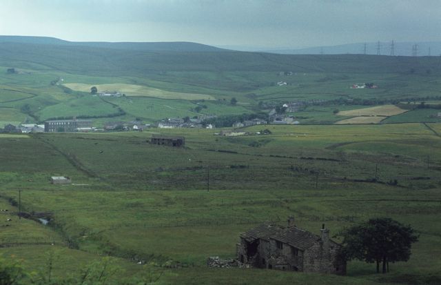
Image: © John Aspden Taken: Unknown
This is a view looking north from Far Bank End Farm. The derelict building in the foreground is called Swims. It was inhabited until around the 1950s. The derelict concrete building in the middle distance on the left was related to coal mining - it was the access point from the Grime Bridge colliery to the Lower Mountain Mine on the west side of the Bacup fault. It was known as Grime Bridge No. 3, or "Griff's Rough". It operated from 1954 to 1962. The derelict building beyond that in the centre of the photo is Moss Barn (which has been rebuilt since this photo was taken) and beyond that is Water.
Images are licensed for reuse under creativecommons.org/licenses/by-sa/2.0
Image Location
Latitude
53.718131
Longitude
-2.229985