Beechings Bar
Introduction
The photograph on this page of Beechings Bar by Thomas Nugent as part of the Geograph project.
The Geograph project started in 2005 with the aim of publishing, organising and preserving representative images for every square kilometre of Great Britain, Ireland and the Isle of Man.

There are currently over 7.5m images from over 14,400 individuals and you can help contribute to the project by visiting https://www.geograph.org.uk
Beechings Bar
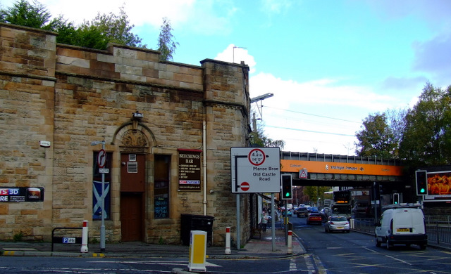
Image: © Thomas Nugent Taken: 30 Oct 2010
A former railway station (hence the name) possibly the original Cathcart station. The current Cathcart station is to the right of the orange bridge. A line once ran above the pub and crossed the road between the photographer and the existing bridge.
Images are licensed for reuse under creativecommons.org/licenses/by-sa/2.0
Image Location
Latitude
55.81691
Longitude
-4.262567