Freelands Tower
Introduction
The photograph on this page of Freelands Tower by Guy Wareham as part of the Geograph project.
The Geograph project started in 2005 with the aim of publishing, organising and preserving representative images for every square kilometre of Great Britain, Ireland and the Isle of Man.

There are currently over 7.5m images from over 14,400 individuals and you can help contribute to the project by visiting https://www.geograph.org.uk
Freelands Tower
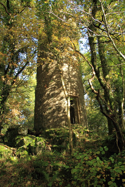
Image: © Guy Wareham Taken: 1 Nov 2010
The tower which was built in the early 1900’s as an observatory and then used during World War II by the Home Guard as a look out post. The tower is private and is unstable, the interior wooden staging having collapsed some time ago.
Images are licensed for reuse under creativecommons.org/licenses/by-sa/2.0
Image Location
Latitude
50.614537
Longitude
-3.757703