First ledge drop above Winston Bridge
Introduction
The photograph on this page of First ledge drop above Winston Bridge by Andy Waddington as part of the Geograph project.
The Geograph project started in 2005 with the aim of publishing, organising and preserving representative images for every square kilometre of Great Britain, Ireland and the Isle of Man.

There are currently over 7.5m images from over 14,400 individuals and you can help contribute to the project by visiting https://www.geograph.org.uk
First ledge drop above Winston Bridge
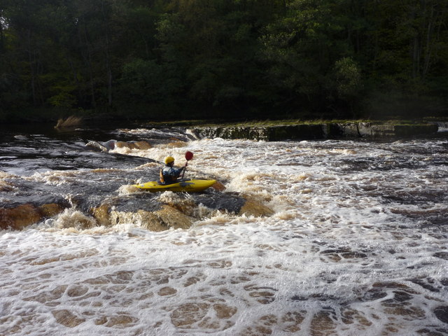
Image: © Andy Waddington Taken: 27 Oct 2010
The River Tees is a fine whitewater river with various sections suitable for trips at different grades. Barnard Castle to Winston Bridge is a longish section with various bits of grade 3 water, which goes in moderately low water, but can get very serious in high water. One of the places that presents problems is a pair of ledge drops just before the end. Big stoppers can form here, but protection is difficult to arrange as the river is too wide for throw lines. This is the first ledge drop, seen at low/medium water (about 0.7m on the Environment Agency gauge at Barnard Castle weir) when it could be run almost anywhere. Phil is taking a line that would work well in higher water, where the ledge projects downstream, giving less of a stopper, even in quite high flows.
Images are licensed for reuse under creativecommons.org/licenses/by-sa/2.0
Image Location
Latitude
54.536831
Longitude
-1.786383