Foel Friog
Introduction
The photograph on this page of Foel Friog by Roger W Haworth as part of the Geograph project.
The Geograph project started in 2005 with the aim of publishing, organising and preserving representative images for every square kilometre of Great Britain, Ireland and the Isle of Man.

There are currently over 7.5m images from over 14,400 individuals and you can help contribute to the project by visiting https://www.geograph.org.uk
Foel Friog
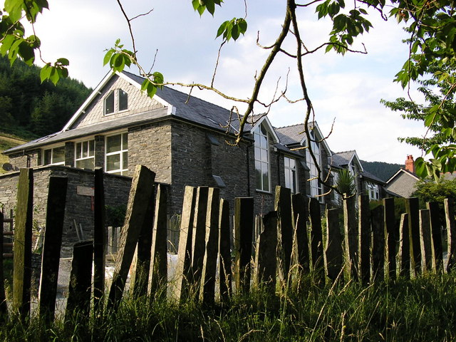
Image: © Roger W Haworth Taken: 25 Jul 2006
This is the former village hall of Aberllefenni, now a private house, situated on the road to Corris near Foel Friog picnic spot. The fence in the foreground is made of slates standing on edge and held together with wire.
Images are licensed for reuse under creativecommons.org/licenses/by-sa/2.0
Image Location
Latitude
52.666492
Longitude
-3.821759