Corris Institute
Introduction
The photograph on this page of Corris Institute by John Lucas as part of the Geograph project.
The Geograph project started in 2005 with the aim of publishing, organising and preserving representative images for every square kilometre of Great Britain, Ireland and the Isle of Man.

There are currently over 7.5m images from over 14,400 individuals and you can help contribute to the project by visiting https://www.geograph.org.uk
Corris Institute
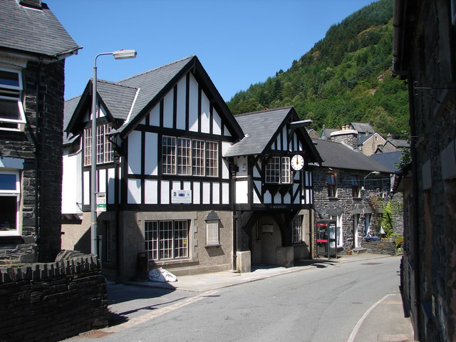
Image: © John Lucas Taken: 3 Aug 2006
Corris Institute, a listed building that had fallen into disrepair, is being regenerated as a community centre with the aid of European and Welsh Assembly grants.
Images are licensed for reuse under creativecommons.org/licenses/by-sa/2.0
Image Location


Leaflet Map data © OpenStreetMap
Latitude
52.654492
Longitude
-3.841959