Development site, Gresham Street, Belfast
Introduction
The photograph on this page of Development site, Gresham Street, Belfast by Albert Bridge as part of the Geograph project.
The Geograph project started in 2005 with the aim of publishing, organising and preserving representative images for every square kilometre of Great Britain, Ireland and the Isle of Man.

There are currently over 7.5m images from over 14,400 individuals and you can help contribute to the project by visiting https://www.geograph.org.uk
Development site, Gresham Street, Belfast
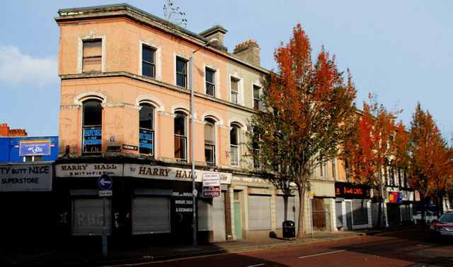
Image: © Albert Bridge Taken: 31 Oct 2010
Buildings, at the corner of Smithfield (left) and Gresham Street, currently displaying an agent’s board offering them for sale as a “development opportunity”.
Images are licensed for reuse under creativecommons.org/licenses/by-sa/2.0
Image Location
Latitude
54.601499
Longitude
-5.932647