Christ Church
Introduction
The photograph on this page of Christ Church by Roger W Haworth as part of the Geograph project.
The Geograph project started in 2005 with the aim of publishing, organising and preserving representative images for every square kilometre of Great Britain, Ireland and the Isle of Man.

There are currently over 7.5m images from over 14,400 individuals and you can help contribute to the project by visiting https://www.geograph.org.uk
Christ Church
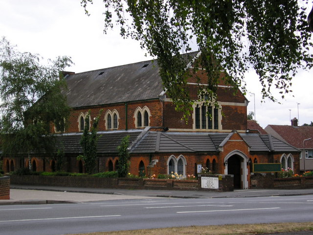
Image: © Roger W Haworth Taken: 2 Aug 2006
United Reformed church in London Road, Swanley Junction on the corner of Kingswood Avenue. This settlement is usually just called Swanley. Swanley Junction is the older name which helps to distinguish it from Swanley Village at Image See http://www.historic-kent.co.uk/vill_s.htm#vills26 .
Images are licensed for reuse under creativecommons.org/licenses/by-sa/2.0
Image Location
Latitude
51.394335
Longitude
0.18054