Garndiffaith Viaduct from the north
Introduction
The photograph on this page of Garndiffaith Viaduct from the north by Jaggery as part of the Geograph project.
The Geograph project started in 2005 with the aim of publishing, organising and preserving representative images for every square kilometre of Great Britain, Ireland and the Isle of Man.

There are currently over 7.5m images from over 14,400 individuals and you can help contribute to the project by visiting https://www.geograph.org.uk
Garndiffaith Viaduct from the north
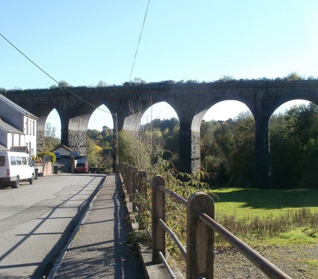
Image: © Jaggery Taken: 25 Oct 2010
The eastern side of the viaduct, viewed along Viaduct Road from near the High Street junction. The brickwork viaduct was built in the 1870s to carry the Brynmawr and Blaenavon Railway across a valley and stream, from Garndiffaith in the east to Talywain in the west. It is about 200 metres long. Closed to passenger traffic in 1941, it remained in use for mineral traffic until 1980. The viaduct now carries National Cycle Route 46.
Images are licensed for reuse under creativecommons.org/licenses/by-sa/2.0
Image Location
Latitude
51.732547
Longitude
-3.068588