Yarner Wells
Introduction
The photograph on this page of Yarner Wells by Derek Harper as part of the Geograph project.
The Geograph project started in 2005 with the aim of publishing, organising and preserving representative images for every square kilometre of Great Britain, Ireland and the Isle of Man.

There are currently over 7.5m images from over 14,400 individuals and you can help contribute to the project by visiting https://www.geograph.org.uk
Yarner Wells
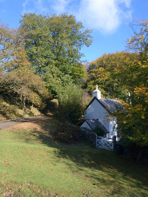
Image: © Derek Harper Taken: 24 Oct 2010
The cottage, at the westernmost corner of Yarner Wood and in the angle of the bend made by the lane between Haytor and Water, is shown on some maps as North Lodge, but seems to have adopted the locality name for the spring here.
Images are licensed for reuse under creativecommons.org/licenses/by-sa/2.0
Image Location
Latitude
50.595128
Longitude
-3.744546