West George Street
Introduction
The photograph on this page of West George Street by Thomas Nugent as part of the Geograph project.
The Geograph project started in 2005 with the aim of publishing, organising and preserving representative images for every square kilometre of Great Britain, Ireland and the Isle of Man.

There are currently over 7.5m images from over 14,400 individuals and you can help contribute to the project by visiting https://www.geograph.org.uk
West George Street
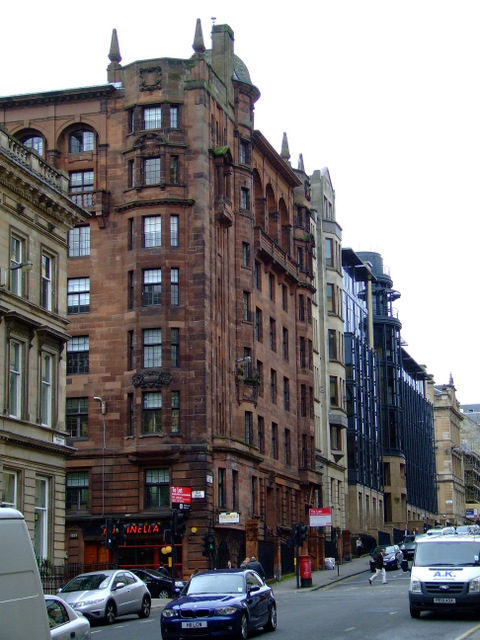
Image: © Thomas Nugent Taken: 22 Oct 2010
At the junction with Hope Street. The red sandstone building is Turnbery House, the style of which is reflected in the new building beyond it.
Images are licensed for reuse under creativecommons.org/licenses/by-sa/2.0
Image Location
Latitude
55.862644
Longitude
-4.258354