Surrey Quays Station
Introduction
The photograph on this page of Surrey Quays Station by Martin Addison as part of the Geograph project.
The Geograph project started in 2005 with the aim of publishing, organising and preserving representative images for every square kilometre of Great Britain, Ireland and the Isle of Man.

There are currently over 7.5m images from over 14,400 individuals and you can help contribute to the project by visiting https://www.geograph.org.uk
Surrey Quays Station
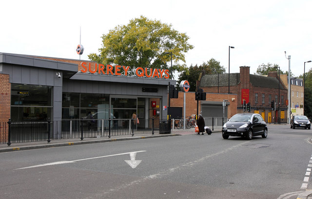
Image: © Martin Addison Taken: 22 Oct 2010
Located in the vee junction of Rotherhithe Old Road and Lower Road, it was originally named Deptford Road when it opened in 1869. It has been renamed on several occasions with Surrey Quays being the latest incarnation. A full history of the station and the East London Line can be found on wikipedia.
Images are licensed for reuse under creativecommons.org/licenses/by-sa/2.0
Image Location
Latitude
51.492959
Longitude
-0.047413