Scheduled for demolition
Introduction
The photograph on this page of Scheduled for demolition by James Allan as part of the Geograph project.
The Geograph project started in 2005 with the aim of publishing, organising and preserving representative images for every square kilometre of Great Britain, Ireland and the Isle of Man.

There are currently over 7.5m images from over 14,400 individuals and you can help contribute to the project by visiting https://www.geograph.org.uk
Scheduled for demolition
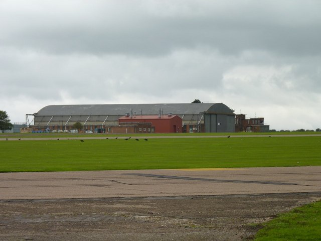
Image: © James Allan Taken: 24 Sep 2010
This aircraft hangar, built in 1940 to accommodate bombers (Wellingtons, Halifaxes and, by 1943, Lancasters) then later used for training aircraft like Harvards (which your geographer used to fly from here) and Jet Provosts, is now surplus to the requirements of what is now a gliding airfield and will shortly be demolished.
Images are licensed for reuse under creativecommons.org/licenses/by-sa/2.0
Image Location
Latitude
53.019457
Longitude
-0.911873