The Wilmar Road, near Lambeg
Introduction
The photograph on this page of The Wilmar Road, near Lambeg by Albert Bridge as part of the Geograph project.
The Geograph project started in 2005 with the aim of publishing, organising and preserving representative images for every square kilometre of Great Britain, Ireland and the Isle of Man.

There are currently over 7.5m images from over 14,400 individuals and you can help contribute to the project by visiting https://www.geograph.org.uk
The Wilmar Road, near Lambeg
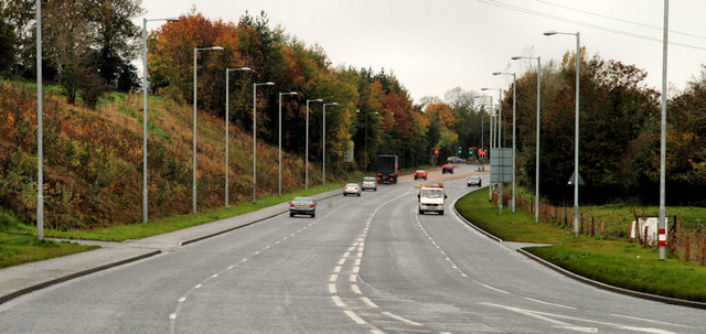
Image: © Albert Bridge Taken: 26 Oct 2010
Part of a road running (under several different names) from Ballymacash, Lisburn to Black’s Road at Dunmurry and acting as a bypass of Hilden, Lambeg and Dunmurry. For those with an interest in such things it is numbered as the A513. The continuation (behind me) to Dunmurry is the A512 while the bypassed road is the A1. Northern Ireland road numbering does not follow any discernible pattern. Indeed the Regional Development minister, in the previous Assembly had to admit (in answer to a question) that the explanation for its origin had been lost with the passage of time.
Images are licensed for reuse under creativecommons.org/licenses/by-sa/2.0
Image Location
Latitude
54.53904
Longitude
-6.034239