Buckingham: London Bridge
Introduction
The photograph on this page of Buckingham: London Bridge by Nigel Cox as part of the Geograph project.
The Geograph project started in 2005 with the aim of publishing, organising and preserving representative images for every square kilometre of Great Britain, Ireland and the Isle of Man.

There are currently over 7.5m images from over 14,400 individuals and you can help contribute to the project by visiting https://www.geograph.org.uk
Buckingham: London Bridge
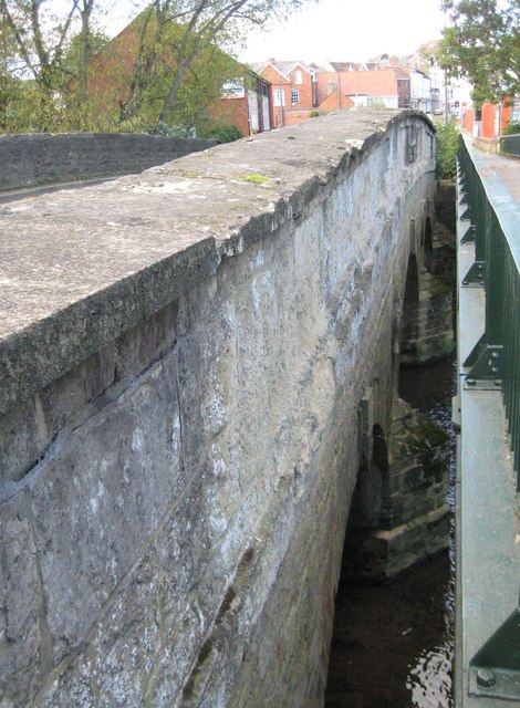
Image: © Nigel Cox Taken: 17 Oct 2010
London Bridge was largely funded by the 1st Marquis of Buckingham to provide a better approach to the town from the south than Image The bridge was completed in 1805, of coursed limestone and limestone ashlar, with three elliptical arches, which are just visible in the photograph here. The bridge and its causeway to the north now form a Grade II Listed Structure. An overall clear view of the whole bridge crossing the River Great Ouse is nigh on impossible these days with the modern footbridge to the right running parallel, close, and at about the same height. However the footbridge does now afford a close up view of the tablet containing the coat of arms of the Marquis of Buckingham in the centre of the downstream side here. The coat of arms, complete with supporters and marquis' coronet, has the impressed mark Coade & Seely, Lambeth, and is dated 1805. It is curious that such effort went into producing this tablet when in 1805 it would have been out of close up sight to all and sundry. Perhaps the designers were prescient enough to foresee 20th century traffic, and the need for a separate pedestrian walkway!
Images are licensed for reuse under creativecommons.org/licenses/by-sa/2.0
Image Location
Latitude
51.998456
Longitude
-0.985884