The Mondriaan development
Introduction
The photograph on this page of The Mondriaan development by Lairich Rig as part of the Geograph project.
The Geograph project started in 2005 with the aim of publishing, organising and preserving representative images for every square kilometre of Great Britain, Ireland and the Isle of Man.

There are currently over 7.5m images from over 14,400 individuals and you can help contribute to the project by visiting https://www.geograph.org.uk
The Mondriaan development
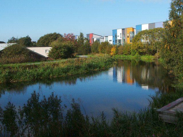
Image: © Lairich Rig Taken: 11 Oct 2010
This is a view over a branch of the Forth and Clyde Canal, looking towards the buildings of Shuna Crescent. These are part of a colourful new housing development whose look is inspired by the later works of Dutch artist Piet Mondrian (see Image). When this photograph was taken, construction was still taking place elsewhere on the site. - - • - - As noted at Image, this new development is on land that had formerly been occupied by industrial buildings. Early OS maps show that, at the end of the nineteenth century, the area of this housing development was the location of (from west to east) a chemical works, a rubber works, a gold extracting works, and Caledonia Foundry. The "chemical works" was Glasgow Lead and Colour Works; see https://canmore.org.uk/site/259600/glasgow-50-56-ruchill-street-glasgow-lead-and-colour-works (at Canmore) for images. The "rubber works" was Glasgow Rubber Works, established by George McLellan and Co., and shown on later OS maps as "Glasgow Rubber and Asbestos Works". See https://canmore.org.uk/site/127638/glasgow-125-129-shuna-street-glasgow-rubber-works (at Canmore) for images and for further details. The "gold extracting works" was operated by the Cassel Gold Extracting Company, and used the MacArthur-Forrest process, or "cyanide process"; the use of this process to extract gold from low-quality ore was then new. The company had acquired patent rights to this process, but these would prove to be the subject of much litigation. An OS map from 1913 shows that the works had expanded to the north-east; on that map, the site is labelled "Cassel Cyanide Works". The last of the above-mentioned works was Caledonia Foundry; this was operated by Kerr and Co., Ltd. See https://canmore.org.uk/site/174589/glasgow-35-9-shuna-street-caledonia-foundry (at Canmore) for images of the foundry building. The company had earlier been based at Firhill.
Images are licensed for reuse under creativecommons.org/licenses/by-sa/2.0
Image Location
Latitude
55.885981
Longitude
-4.279539