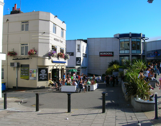
Western Front and Churchill Square
Introduction
The photograph on this page of Western Front and Churchill Square by Simon Carey as part of the Geograph project.
The Geograph project started in 2005 with the aim of publishing, organising and preserving representative images for every square kilometre of Great Britain, Ireland and the Isle of Man.
There are currently over 7.5m images from over 14,400 individuals and you can help contribute to the project by visiting https://www.geograph.org.uk

Image: © Simon Carey Taken: 30 Jul 2006
Exit Imperial Arcade by the southern side then cross over Western Road and head east a little. This is the eastern side of the Churchill Square development occupied by Borders who are one of the few shops to have a separate entrance and not be bound by the closing times of the mall. Another place where old clashes with the new. The two pubs on view, the Western Front (formerly the Cranbourne Arms) and Polar Bar (formerly the Lamb Inn) front onto what was formerly Upper Russell Street which headed south then turned west before ending at Russell Square. The first road on the left is called Farm Yard and is a reminder of the days when this marked the western boundary of built up Brighton. The second road on the left is Cranbourne Street now a pedestrianised shopping street linking West Street with Churchill Square. Click on the link to take you to the next square. http://www.geograph.org.uk/photo/212526

