
Queens Square
Introduction
The photograph on this page of Queens Square by Simon Carey as part of the Geograph project.
The Geograph project started in 2005 with the aim of publishing, organising and preserving representative images for every square kilometre of Great Britain, Ireland and the Isle of Man.

There are currently over 7.5m images from over 14,400 individuals and you can help contribute to the project by visiting https://www.geograph.org.uk
Queens Square
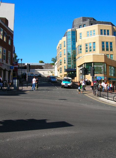
Image: © Simon Carey Taken: 30 Jul 2006
Head south down Zion Gardens and continue in the same direction down Air Street which meets Queens Square on the right side of the photograph. The square was built from the 1850s onwards and has seen a few changes since. A church stood on the east side until 1983 when it was demolished to make way for a new office development. The structure on the northern side of the square was originally a Territorial Army drill hall which was turned into an ice rink in 1970. Unfortunately, that facility has recently closed and there are plans to redevelop the site. The same view of Queens Square in 1935 can be found here http://www.citylibraries.info/pictures/big_picture.asp?Search=Place&Place=BRIGHTON%20TOWN%20CENTRE&PlaceID=12&SubPlace=Queen's%20Square&SubPlaceID=228&Record=3&Records=4&ImageID=1745&From=List&StartPos=1&Picture=Photos%2FPic02%2F01372.jpg . Air Street on the right side of the picture is a remnant of the slums from the early 19th century though all the buildings have now gone and it is a small pedestrianised shopping street. Click on the link to take you to the next page. http://www.geograph.org.uk/photo/212524
Images are licensed for reuse under creativecommons.org/licenses/by-sa/2.0
Image Location

Latitude
50.823476
Longitude
-0.14434