Spiller's Wharf
Introduction
The photograph on this page of Spiller's Wharf by MSX as part of the Geograph project.
The Geograph project started in 2005 with the aim of publishing, organising and preserving representative images for every square kilometre of Great Britain, Ireland and the Isle of Man.

There are currently over 7.5m images from over 14,400 individuals and you can help contribute to the project by visiting https://www.geograph.org.uk
Spiller's Wharf
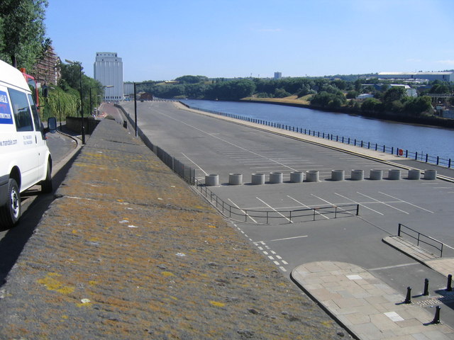
Image: © MSX Taken: 28 Jul 2006
Huge expanse of land in front of Spiller's Flour Mill. Was used by learner drivers and weekend Hot Rod enthusiasts but now it's fenced off, presumably until the next Orange Evolution Festival.
Images are licensed for reuse under creativecommons.org/licenses/by-sa/2.0
Image Location


Leaflet Map data © OpenStreetMap
Latitude
54.969012
Longitude
-1.584471