Sandford Arms
Introduction
The photograph on this page of Sandford Arms by Andrew Curtis as part of the Geograph project.
The Geograph project started in 2005 with the aim of publishing, organising and preserving representative images for every square kilometre of Great Britain, Ireland and the Isle of Man.

There are currently over 7.5m images from over 14,400 individuals and you can help contribute to the project by visiting https://www.geograph.org.uk
Sandford Arms
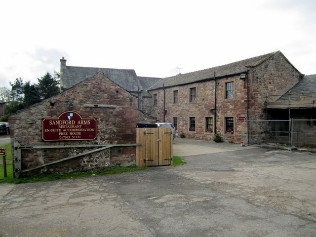
Image: © Andrew Curtis Taken: 22 Oct 2010
A residential inn in the quiet village of Sandfod was converted from C18th farm buildings. The south side of the original farmhouse is shown here Image Well worth a stop to relax from the manic traffic of the A66.
Images are licensed for reuse under creativecommons.org/licenses/by-sa/2.0
Image Location
Latitude
54.540252
Longitude
-2.417589