Druid Street
Introduction
The photograph on this page of Druid Street by Martin Addison as part of the Geograph project.
The Geograph project started in 2005 with the aim of publishing, organising and preserving representative images for every square kilometre of Great Britain, Ireland and the Isle of Man.

There are currently over 7.5m images from over 14,400 individuals and you can help contribute to the project by visiting https://www.geograph.org.uk
Druid Street
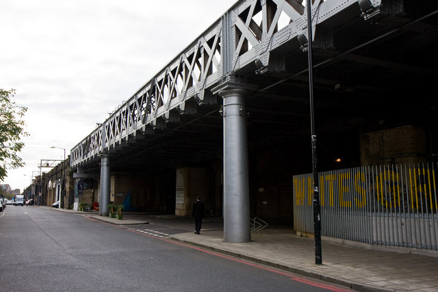
Image: © Martin Addison Taken: 22 Oct 2010
This Bermondsey street runs parallel with the railway line into London Bridge station for around 3/4km from Jamaica Road to the St. Olaves Estate, crossing Tower Bridge Road midway. The railway is carried above the streets on a mixture of brick arches and bridges like the steel girder construction in this photo. The mix of construction methods is probably due to widening of the trackbed and possibly the complexity of the arrangement of side-streets being crossed at this point. Whites Grounds on the right is now a skateboard park under the arches but was one of three side-streets passing under the railway at this point at varying angles. The railway arches along Druid Street were used as air raid shelters during World War II. On the night of 25th October 1940 one received a direct hit from a German bomb resulting in the deaths of many local people - the count is variously quoted as between 77 and 105. A plaque on the bridge abutment at Tanner Street records the event.
Images are licensed for reuse under creativecommons.org/licenses/by-sa/2.0
Image Location
Latitude
51.501655
Longitude
-0.078452