Padbury: The Church of St Mary the Virgin
Introduction
The photograph on this page of Padbury: The Church of St Mary the Virgin by Nigel Cox as part of the Geograph project.
The Geograph project started in 2005 with the aim of publishing, organising and preserving representative images for every square kilometre of Great Britain, Ireland and the Isle of Man.

There are currently over 7.5m images from over 14,400 individuals and you can help contribute to the project by visiting https://www.geograph.org.uk
Padbury: The Church of St Mary the Virgin
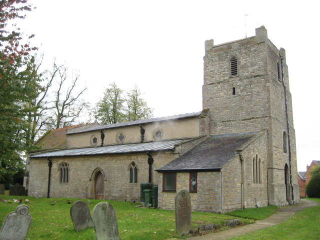
Image: © Nigel Cox Taken: 17 Oct 2010
The nave and chancel date from the 13th century as did the original tower which was however rebuilt in the 17th century. The structure is a Grade II* Listed Building. The apparent flaw in the photograph is actually an emission from a boiler flue! This contribution shows how cartographic demands can lead to inaccuracies in mapping. The location of the symbol for the church on the Ordnance Survey 1:50,000 scale mapping plots at least 50 metres away from the actual physical centre of the church on the ground.
Images are licensed for reuse under creativecommons.org/licenses/by-sa/2.0
Image Location
Latitude
51.972077
Longitude
-0.951105