Mausoleum at St. Andrew's Church, Hopper Hill
Introduction
The photograph on this page of Mausoleum at St. Andrew's Church, Hopper Hill by Trevor Littlewood as part of the Geograph project.
The Geograph project started in 2005 with the aim of publishing, organising and preserving representative images for every square kilometre of Great Britain, Ireland and the Isle of Man.

There are currently over 7.5m images from over 14,400 individuals and you can help contribute to the project by visiting https://www.geograph.org.uk
Mausoleum at St. Andrew's Church, Hopper Hill
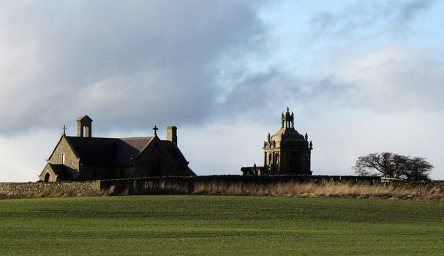
Image: © Trevor Littlewood Taken: 17 Nov 2009
St. Andrew's Church stands at the top of Greymare Hill, a rise to 295m, east of the A68. The building is a small and simple one and the location is remarkable more for the mausoleum in the graveyard built by Humfrey Hopper in memory of his wife Jane, which is seen to the right of the church in the photograph.
Images are licensed for reuse under creativecommons.org/licenses/by-sa/2.0
Image Location
Latitude
54.89197
Longitude
-1.93028