Boundary post on corner of Thomas Lane and Thingwall Lane
Introduction
The photograph on this page of Boundary post on corner of Thomas Lane and Thingwall Lane by Raymond Knapman as part of the Geograph project.
The Geograph project started in 2005 with the aim of publishing, organising and preserving representative images for every square kilometre of Great Britain, Ireland and the Isle of Man.

There are currently over 7.5m images from over 14,400 individuals and you can help contribute to the project by visiting https://www.geograph.org.uk
Boundary post on corner of Thomas Lane and Thingwall Lane
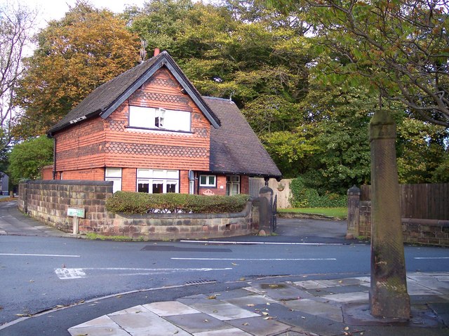
Image: © Raymond Knapman Taken: 19 Oct 2010
This post indicates Broadgreen on one side and Thingwall on opposite side,adding "no thoroughfare" It is dated 1776. Opposite it is a lodge house for Ashfield House, no longer existent.
Images are licensed for reuse under creativecommons.org/licenses/by-sa/2.0
Image Location
Latitude
53.414453
Longitude
-2.891529