Clarence Gardens
Introduction
The photograph on this page of Clarence Gardens by Simon Carey as part of the Geograph project.
The Geograph project started in 2005 with the aim of publishing, organising and preserving representative images for every square kilometre of Great Britain, Ireland and the Isle of Man.

There are currently over 7.5m images from over 14,400 individuals and you can help contribute to the project by visiting https://www.geograph.org.uk
Clarence Gardens
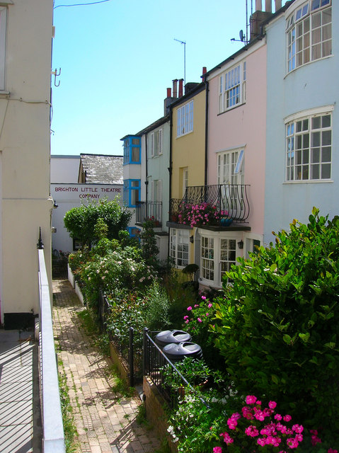
Image: © Simon Carey Taken: 30 Jul 2006
Head east along Western Road and turn south into Clarence Square; as the road turns east Clarence Gardens occupies a small corner. Clarence Square was an early development from the 1800s onwards and was largely competed by the 1820s. At the end of this row is a small hall originally built as a chapel in 1830. Since then it has been an infants school (1852), Mission Hall (1884), an Art School (1899) and from 1940 onwards been home to the Little Theatre Company - Little as the capacity is only 80, making it the smallest theatre in Brighton. Click on the link to take you to the next page. http://www.geograph.org.uk/photo/211921
Images are licensed for reuse under creativecommons.org/licenses/by-sa/2.0
Image Location
Latitude
50.823543
Longitude
-0.148596