Benson Street, Lisburn (2)
Introduction
The photograph on this page of Benson Street, Lisburn (2) by Albert Bridge as part of the Geograph project.
The Geograph project started in 2005 with the aim of publishing, organising and preserving representative images for every square kilometre of Great Britain, Ireland and the Isle of Man.

There are currently over 7.5m images from over 14,400 individuals and you can help contribute to the project by visiting https://www.geograph.org.uk
Benson Street, Lisburn (2)
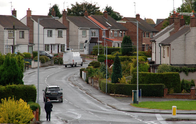
Image: © Albert Bridge Taken: 19 Oct 2010
See Image Before the opening of the Thiepval Road Image, Benson Street was a through street from the Antrim Road to the Causeway End Road. The new road cut it leaving a short stub (behind me) at the Antrim Road end. This is the view from the Thiepval Road to the Causeway End Road. The connection from this part of the street to the Antrim Road is by the Bentrim Road (bottom right).
Images are licensed for reuse under creativecommons.org/licenses/by-sa/2.0
Image Location
Latitude
54.513515
Longitude
-6.056004