
The Crescent, Clifton Hill
Introduction
The photograph on this page of The Crescent, Clifton Hill by Simon Carey as part of the Geograph project.
The Geograph project started in 2005 with the aim of publishing, organising and preserving representative images for every square kilometre of Great Britain, Ireland and the Isle of Man.

There are currently over 7.5m images from over 14,400 individuals and you can help contribute to the project by visiting https://www.geograph.org.uk
The Crescent, Clifton Hill
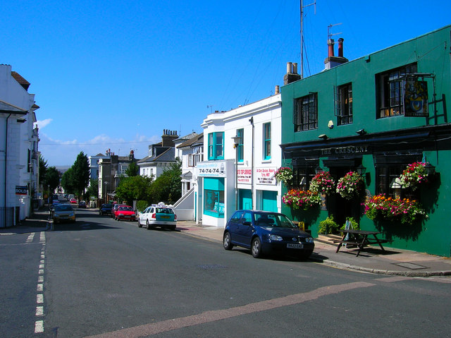
Image: © Simon Carey Taken: 30 Jul 2006
Continue north up Denmark Terrace until you reach the crossroads of Windlesham Avenue and Clifton Hill. Turn east into the latter and continue until you meet with the junction of Powis Road. On the northern side of the road is The Crescent pub built to serve the travellers along what was once a coach road linking Brighton and West Blatchington. From the 1830s onwards this area was being built up and the pub changed from serving travellers to serving the local community. Furthermore, every second Thursday of the month I host a music quiz there! The taxi building next door has been painted to match the colours of the cars which themselves are so coloured to match the matching turquoise and whites of the Pavilion and piers and bandstands of the seafront. Click on the link to take you to the next page. http://www.geograph.org.uk/photo/211900
Images are licensed for reuse under creativecommons.org/licenses/by-sa/2.0
Image Location

Latitude
50.82806
Longitude
-0.149838