Site of Upper Sydenham Station
Introduction
The photograph on this page of Site of Upper Sydenham Station by Malc McDonald as part of the Geograph project.
The Geograph project started in 2005 with the aim of publishing, organising and preserving representative images for every square kilometre of Great Britain, Ireland and the Isle of Man.

There are currently over 7.5m images from over 14,400 individuals and you can help contribute to the project by visiting https://www.geograph.org.uk
Site of Upper Sydenham Station
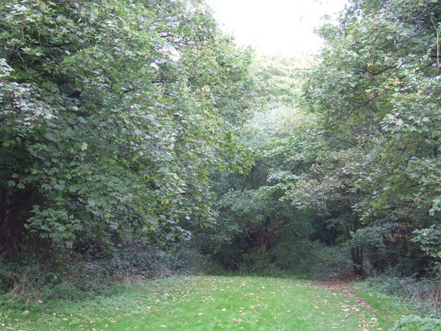
Image: © Malc McDonald Taken: 17 Oct 2010
There is little in this picture to give away that it was once a railway station, although if you look very closely, you might just make out part of a tunnel entrance through the trees in the centre of the image. The railway was a branch line from Nunhead to Crystal Palace High Level station. The Crystal Palace itself was destroyed by fire in 1936, but the branch line struggled on, with few passengers, finally closing in 1954. Housing has been built over some parts of the route but nature has reclaimed the site of Upper Sydenham station. There are photos of the station on the 'Disused Stations' website, at http://www.disused-stations.org.uk/u/upper_sydenham/index.shtml
Images are licensed for reuse under creativecommons.org/licenses/by-sa/2.0
Image Location
Latitude
51.430835
Longitude
-0.07006