Trimley St Martin?s church
Introduction
The photograph on this page of Trimley St Martin?s church by Adrian S Pye as part of the Geograph project.
The Geograph project started in 2005 with the aim of publishing, organising and preserving representative images for every square kilometre of Great Britain, Ireland and the Isle of Man.

There are currently over 7.5m images from over 14,400 individuals and you can help contribute to the project by visiting https://www.geograph.org.uk
Trimley St Martin?s church
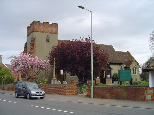
Image: © Adrian S Pye Taken: 17 Apr 2007
The Trimleys, as they are known come together at their two churches. The parish boundary runs down the centre of the graveyard between them; they stand only 100 yards apart. St Martin is a 14th century church. However, there are modern additions such as the battlements on the tower, and the nave and porch. The walls everywhere are rendered with horrible cement and no attempt at decoration or breaking up the plainness has been attempted. The font is 12th century with a square bowl and chevron decoration on the angles. The holy table is of the Stuart period with carved legs. The Royal Arms, which are carved in oak are those of George I. The parish was consolidated with its neighbour Stratton St Peter many years ago and there, nothing remains of the church.
Images are licensed for reuse under creativecommons.org/licenses/by-sa/2.0
Image Location
Latitude
51.985667
Longitude
1.314386