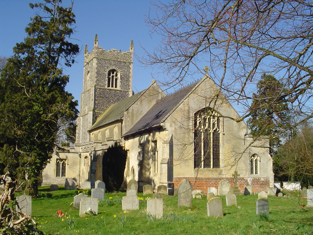
Thrandeston St Margaret?s church
Introduction
The photograph on this page of Thrandeston St Margaret?s church by Adrian S Pye as part of the Geograph project.
The Geograph project started in 2005 with the aim of publishing, organising and preserving representative images for every square kilometre of Great Britain, Ireland and the Isle of Man.
There are currently over 7.5m images from over 14,400 individuals and you can help contribute to the project by visiting https://www.geograph.org.uk

Image: © Adrian S Pye Taken: 12 Mar 2007
On the west tower the layers of flint between the quoins shows how much upward progress was made each year by the builders. A dark layer formed while no work was taking place can be seen a varying intervals. At the top, the embattled parapet has delicately crocketted pinnacles at each corner. There is a scratch dial on one of the buttresses. The clerestory windows light up the nave and roof, around the cornice of which are painted shields and foliate designs. A typical East Anglian font stands on a plinth the same size as the base. The pulpit is octagonal with open traceried panels. A poor-box, of about 1639, stands near the door on a pillar. There is some beautifully carved traceried panelling to admire on the 15th century stalls and figures of St Peter and St John at the entrance. Above the chancel arch hang the Royal Arms of Queen Victoria.

