The site of Blacon Station
Introduction
The photograph on this page of The site of Blacon Station by John S Turner as part of the Geograph project.
The Geograph project started in 2005 with the aim of publishing, organising and preserving representative images for every square kilometre of Great Britain, Ireland and the Isle of Man.

There are currently over 7.5m images from over 14,400 individuals and you can help contribute to the project by visiting https://www.geograph.org.uk
The site of Blacon Station
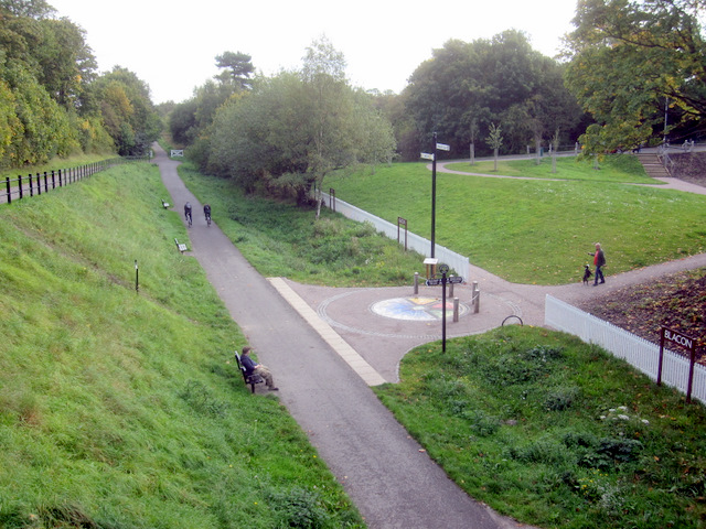
Image: © John S Turner Taken: 16 Oct 2010
Blacon Station was closed to passengers on the 9th September 1968, although the line continued in use until the 1990s. The station buildings fell into disrepair and were demolished in the 1980s. This photo is an attempt to recreate Ben Brooksbank's 1961 photo Image, since which time the trees have grown considerably. The only feature which seems to match is the tall pine tree, prominent at trackside in Ben's photo, and still just visible in this photo, above the surrounding trees, near the small white fence in the distance. The trackbed is now part of Sustrans National Route 5 - Chester to Connah's Quay, and the Blacon Station site has been redeveloped as an access point. The colourful circle in the centre of the photo is a mosaic "Created by Caroline Perry with support from the young people of Blacon".
Images are licensed for reuse under creativecommons.org/licenses/by-sa/2.0
Image Location
Latitude
53.206366
Longitude
-2.925832