Seafront shelter at Herne Bay
Introduction
The photograph on this page of Seafront shelter at Herne Bay by Marathon as part of the Geograph project.
The Geograph project started in 2005 with the aim of publishing, organising and preserving representative images for every square kilometre of Great Britain, Ireland and the Isle of Man.

There are currently over 7.5m images from over 14,400 individuals and you can help contribute to the project by visiting https://www.geograph.org.uk
Seafront shelter at Herne Bay
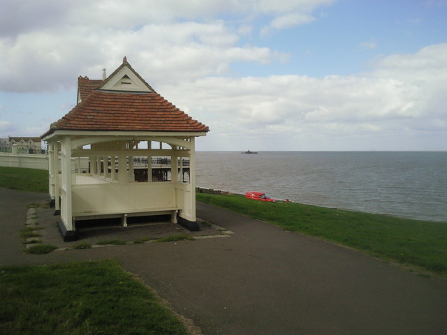
Image: © Marathon Taken: 17 Sep 2010
This attractive and well-kept shelter can be seen below Beacon Hill on the eastern approach to Herne Bay. To the right of it out to sea is the end of Herne Bay Pier which was the second longest in the country before the centre section was destroyed.
Images are licensed for reuse under creativecommons.org/licenses/by-sa/2.0
Image Location


Leaflet Map data © OpenStreetMap
Latitude
51.372615
Longitude
1.137241