Furze Hill House
Introduction
The photograph on this page of Furze Hill House by Simon Carey as part of the Geograph project.
The Geograph project started in 2005 with the aim of publishing, organising and preserving representative images for every square kilometre of Great Britain, Ireland and the Isle of Man.

There are currently over 7.5m images from over 14,400 individuals and you can help contribute to the project by visiting https://www.geograph.org.uk
Furze Hill House
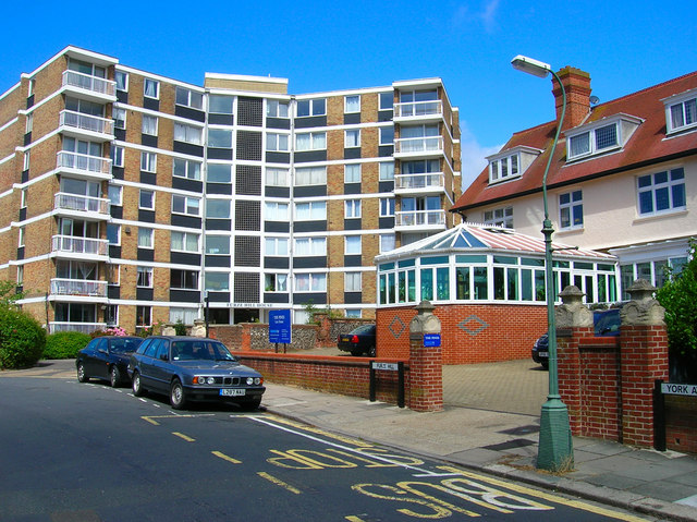
Image: © Simon Carey Taken: 30 Jul 2006
Having left the park turn left up Furze Hill towards the junction with York Avenue. We are still in Hove and in the area once part of Wick Hall now a number of blocks of flats. This one was constructed in the 1960s. Click on the link to take you to the next slide. http://www.geograph.org.uk/photo/211398
Images are licensed for reuse under creativecommons.org/licenses/by-sa/2.0
Image Location


Leaflet Map data © OpenStreetMap
Latitude
50.82815
Longitude
-0.155514