M2 slip-road Belfast
Introduction
The photograph on this page of M2 slip-road Belfast by Albert Bridge as part of the Geograph project.
The Geograph project started in 2005 with the aim of publishing, organising and preserving representative images for every square kilometre of Great Britain, Ireland and the Isle of Man.

There are currently over 7.5m images from over 14,400 individuals and you can help contribute to the project by visiting https://www.geograph.org.uk
M2 slip-road Belfast
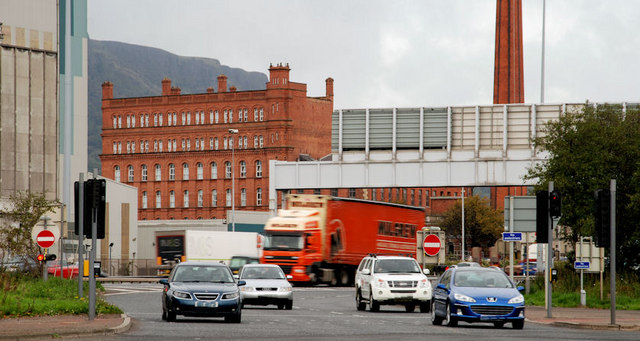
Image: © Albert Bridge Taken: 15 Oct 2010
An off-slip, near the end of the M2 at Duncrue Street, just north of the (in)famous Nelson Street Image off-slip. This was the end of the M2 before the short extension across Dock Street Image Not nearly as busy as Nelson Street, it provides an alternative route to the city centre but, for whatever reason, is not as popular. The large red building (background) is the former Jennymount mill.
Images are licensed for reuse under creativecommons.org/licenses/by-sa/2.0
Image Location
Latitude
54.613234
Longitude
-5.920131