Ilsington: by the road to Beckaford
Introduction
The photograph on this page of Ilsington: by the road to Beckaford by Martin Bodman as part of the Geograph project.
The Geograph project started in 2005 with the aim of publishing, organising and preserving representative images for every square kilometre of Great Britain, Ireland and the Isle of Man.

There are currently over 7.5m images from over 14,400 individuals and you can help contribute to the project by visiting https://www.geograph.org.uk
Ilsington: by the road to Beckaford
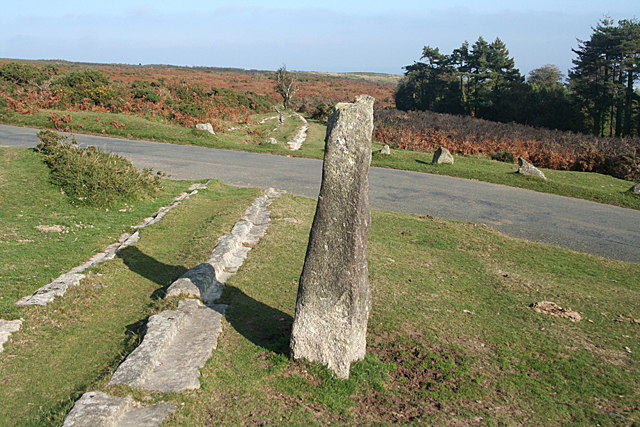
Image: © Martin Bodman Taken: 13 Oct 2010
The Haytor Granite Tramway once crossed the road here. It then heads downhill by the road to Bovey Tracey and disappears into Yarner Wood on its way to Ventiford wharf on the Stover Canal. For more on the tramway see Image In Ilsington parish
Images are licensed for reuse under creativecommons.org/licenses/by-sa/2.0
Image Location
Latitude
50.584583
Longitude
-3.740059