Tank House, Chare Bank
Introduction
The photograph on this page of Tank House, Chare Bank by Andrew Curtis as part of the Geograph project.
The Geograph project started in 2005 with the aim of publishing, organising and preserving representative images for every square kilometre of Great Britain, Ireland and the Isle of Man.

There are currently over 7.5m images from over 14,400 individuals and you can help contribute to the project by visiting https://www.geograph.org.uk
Tank House, Chare Bank
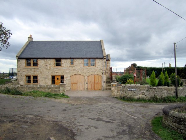
Image: © Andrew Curtis Taken: 15 Oct 2010
Recently rebuilt house on the site of a ruin. The house name refers to the stone-built water tank that stood on this hilltop site (close to the site of the 12th Milecastle of Hadrian's Wall) which was the village water supply from the mid C19th, fed from springs rising near East Heddon Image It went out of use when a metal tank on legs was provided nearby, and now itself demolished and replaced by mains water. http://heddonhistory.weebly.com/water-supplies.html
Images are licensed for reuse under creativecommons.org/licenses/by-sa/2.0
Image Location
Latitude
54.99695
Longitude
-1.791139