Dredging the River Lagan, Belfast - 2010/11 (25)
Introduction
The photograph on this page of Dredging the River Lagan, Belfast - 2010/11 (25) by Albert Bridge as part of the Geograph project.
The Geograph project started in 2005 with the aim of publishing, organising and preserving representative images for every square kilometre of Great Britain, Ireland and the Isle of Man.

There are currently over 7.5m images from over 14,400 individuals and you can help contribute to the project by visiting https://www.geograph.org.uk
Dredging the River Lagan, Belfast - 2010/11 (25)
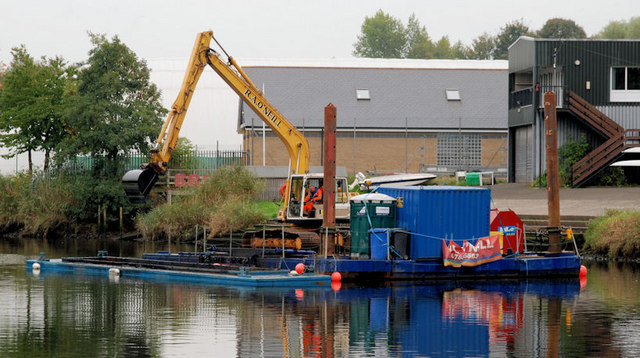
Image: © Albert Bridge Taken: 14 Oct 2010
In the nine days since Image the operations have moved downstream to two places. This one (beside the Belfast Boat Club) on the south western side of the Lagan and one upstream of the King’s Bridge Image There is an empty barge alongside the pontoon ready to receive the next load. A few minutes before the photo a loaded barge had departed for Queen’s Quay Image
Images are licensed for reuse under creativecommons.org/licenses/by-sa/2.0
Image Location
Latitude
54.57011
Longitude
-5.925576