School Lane, Lower Cambourne
Introduction
The photograph on this page of School Lane, Lower Cambourne by John Brightley as part of the Geograph project.
The Geograph project started in 2005 with the aim of publishing, organising and preserving representative images for every square kilometre of Great Britain, Ireland and the Isle of Man.

There are currently over 7.5m images from over 14,400 individuals and you can help contribute to the project by visiting https://www.geograph.org.uk
School Lane, Lower Cambourne
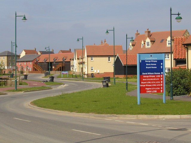
Image: © John Brightley Taken: 13 May 2004
A view in which the standard Cambourne streetlights are very much in evidence, and showing one of the development signboards pointing the way to phases which are in the course of construction or sale. I believe the red signs on this board were to show the construction sites and the blue signs the way to the developers sales offices.
Images are licensed for reuse under creativecommons.org/licenses/by-sa/2.0
Image Location
Latitude
52.218041
Longitude
-0.077546