School Lane, Lower Cambourne
Introduction
The photograph on this page of School Lane, Lower Cambourne by John Brightley as part of the Geograph project.
The Geograph project started in 2005 with the aim of publishing, organising and preserving representative images for every square kilometre of Great Britain, Ireland and the Isle of Man.

There are currently over 7.5m images from over 14,400 individuals and you can help contribute to the project by visiting https://www.geograph.org.uk
School Lane, Lower Cambourne
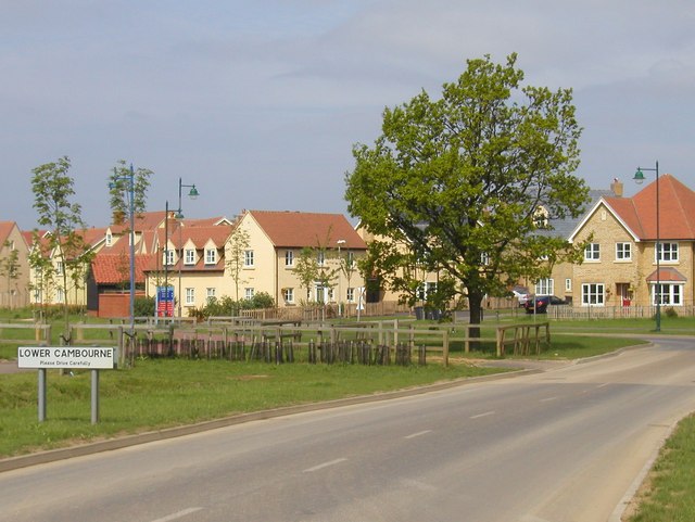
Image: © John Brightley Taken: 13 May 2004
The entrance to Lower Cambourne from the east, showing the village name sign. The standard Cambourne streetlights are also very much in evidence. The new planting in the middle of the photograph is along a bridleway known as Crow Dean (going from left to right in the photo) which existed before the Cambourne development was started.
Images are licensed for reuse under creativecommons.org/licenses/by-sa/2.0
Image Location
Latitude
52.217838
Longitude
-0.076091