
Eyemouth Harbour
Introduction
The photograph on this page of Eyemouth Harbour by Lisa Jarvis as part of the Geograph project.
The Geograph project started in 2005 with the aim of publishing, organising and preserving representative images for every square kilometre of Great Britain, Ireland and the Isle of Man.

There are currently over 7.5m images from over 14,400 individuals and you can help contribute to the project by visiting https://www.geograph.org.uk
Eyemouth Harbour
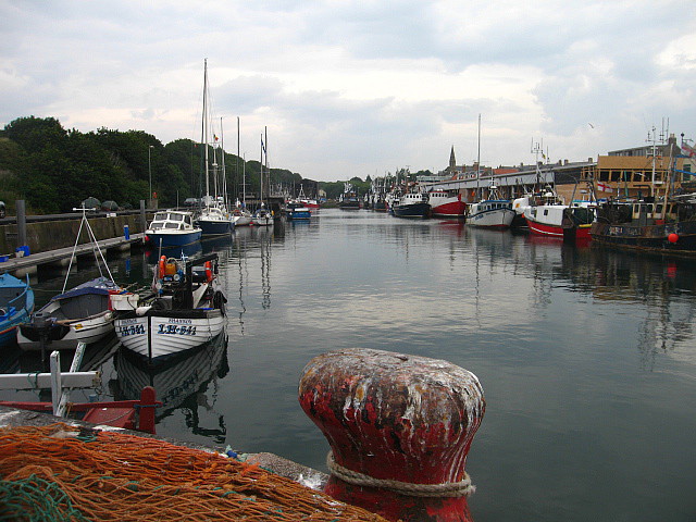
Image: © Lisa Jarvis Taken: 29 Jul 2006
Eyemouth's harbour stretches back along the Eye Water, effectively forming the eastern edge of the town. Fishing played a vital part in the local economy as early as 1298, but it has also been a source of tragedy. During the 1800s Eyemouth's harbour was not improved as quickly as many, and its entrance was very tricky in rough weather. In 1881, 189 fishermen, including 129 from Eyemouth itself, lost their lives. The harbour was later improved to provide a much safer entrance. Most of Eyemouth's current harbour dates back to a major rebuilding in 1965.
Images are licensed for reuse under creativecommons.org/licenses/by-sa/2.0
Image Location

Latitude
55.870937
Longitude
-2.089464