Pontypool and Cwm Afon
Introduction
The photograph on this page of Pontypool and Cwm Afon by M J Richardson as part of the Geograph project.
The Geograph project started in 2005 with the aim of publishing, organising and preserving representative images for every square kilometre of Great Britain, Ireland and the Isle of Man.

There are currently over 7.5m images from over 14,400 individuals and you can help contribute to the project by visiting https://www.geograph.org.uk
Pontypool and Cwm Afon
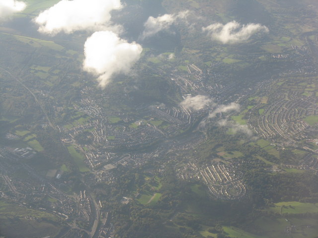
Image: © M J Richardson Taken: 4 Oct 2010
With the A472 heading westwards to Abercynon at the left hand side of the picture, and the A4043 heading up the valley right to Abertillery.
Images are licensed for reuse under creativecommons.org/licenses/by-sa/2.0
Image Location
Latitude
51.707661
Longitude
-3.036162