Grey Ditch from Smalldale
Introduction
The photograph on this page of Grey Ditch from Smalldale by Dave Dunford as part of the Geograph project.
The Geograph project started in 2005 with the aim of publishing, organising and preserving representative images for every square kilometre of Great Britain, Ireland and the Isle of Man.

There are currently over 7.5m images from over 14,400 individuals and you can help contribute to the project by visiting https://www.geograph.org.uk
Grey Ditch from Smalldale
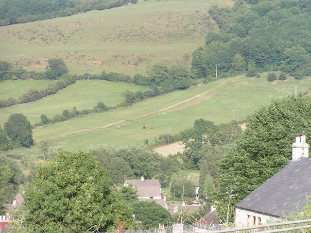
Image: © Dave Dunford Taken: 27 Jul 2006
The earthwork running up the middle of the field in the centre of the picture is the Grey Ditch, thought to be an early medieval boundary marker (see also Image for a view of a separate section, and http://magic.defra.gov.uk/rsm/29813.pdf for more information). Taken from Smalldale looking over the houses of Bradwell.
Images are licensed for reuse under creativecommons.org/licenses/by-sa/2.0
Image Location
Latitude
53.330122
Longitude
-1.735693