Knodishall St Lawrence?s church
Introduction
The photograph on this page of Knodishall St Lawrence?s church by Adrian S Pye as part of the Geograph project.
The Geograph project started in 2005 with the aim of publishing, organising and preserving representative images for every square kilometre of Great Britain, Ireland and the Isle of Man.

There are currently over 7.5m images from over 14,400 individuals and you can help contribute to the project by visiting https://www.geograph.org.uk
Knodishall St Lawrence?s church
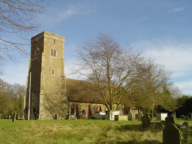
Image: © Adrian S Pye Taken: 15 Feb 2007
Knodishall parish includes the old parish of Buxlow or Buxlee, remains of the church can be seen at > http://www.geograph.org.uk/photo/2084853 now known as Knodishall Green. The church sits on a prominence and the 15th century tower can be seen some distance away. The tower is without battlements and would look rather plain if it were not for the flushwork and armorial shields on the parapet; and a scratch dial can be found on the south doorway. There is a west doorway set into the tower. There are still signs of the Norman builder’s achievements if you look hard enough. The purbeck font is typical 13th century example with shallow carving on the bowl. It has a central shaft and eight detached columns. The pulpit is of Stuart origins and there are three traceried panels of a 16th century screen.
Images are licensed for reuse under creativecommons.org/licenses/by-sa/2.0
Image Location
Latitude
52.202338
Longitude
1.5492