Stoke Newington: St. Matthias Church
Introduction
The photograph on this page of Stoke Newington: St. Matthias Church by Dr Neil Clifton as part of the Geograph project.
The Geograph project started in 2005 with the aim of publishing, organising and preserving representative images for every square kilometre of Great Britain, Ireland and the Isle of Man.

There are currently over 7.5m images from over 14,400 individuals and you can help contribute to the project by visiting https://www.geograph.org.uk
Stoke Newington: St. Matthias Church
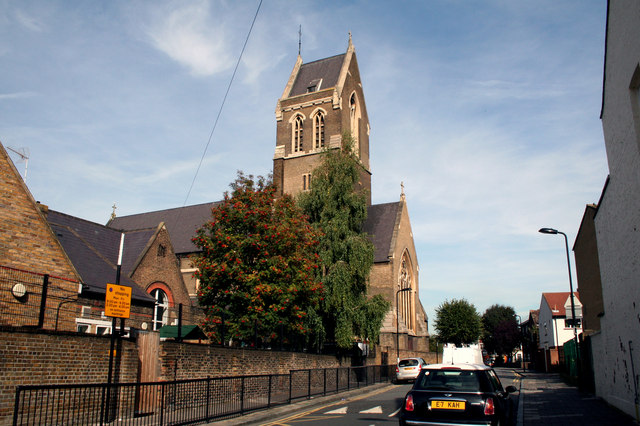
Image: © Dr Neil Clifton Taken: 7 Oct 2010
I understand that this church,built around 1850, was virtually flattened by the Luftwaffe during World War II, but rebuilt to the original pattern in the 1950s. I believe it has Grade I Listed status, but I can't really see why, the exterior showing little of interest apart from the massive tall tower.
Images are licensed for reuse under creativecommons.org/licenses/by-sa/2.0
Image Location
Latitude
51.552383
Longitude
-0.079056