Fleur de Lys, Market Street, Hailsham
Introduction
The photograph on this page of Fleur de Lys, Market Street, Hailsham by Simon Carey as part of the Geograph project.
The Geograph project started in 2005 with the aim of publishing, organising and preserving representative images for every square kilometre of Great Britain, Ireland and the Isle of Man.

There are currently over 7.5m images from over 14,400 individuals and you can help contribute to the project by visiting https://www.geograph.org.uk
Fleur de Lys, Market Street, Hailsham
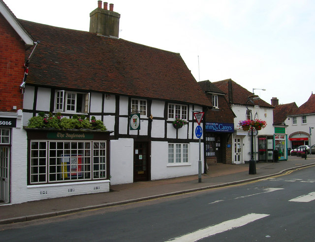
Image: © Simon Carey Taken: 27 Jul 2006
The building dates from around 1540 and was originally an inn. It has also been the town's poorhouse, a butchers, confectioners and numerous other shops. Today it is home to Hailsham Town Council.
Images are licensed for reuse under creativecommons.org/licenses/by-sa/2.0
Image Location
Latitude
50.861326
Longitude
0.259315