The Quoile, Downpatrick (2)
Introduction
The photograph on this page of The Quoile, Downpatrick (2) by Albert Bridge as part of the Geograph project.
The Geograph project started in 2005 with the aim of publishing, organising and preserving representative images for every square kilometre of Great Britain, Ireland and the Isle of Man.

There are currently over 7.5m images from over 14,400 individuals and you can help contribute to the project by visiting https://www.geograph.org.uk
The Quoile, Downpatrick (2)
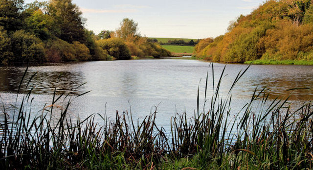
Image: © Albert Bridge Taken: 6 Oct 2010
There is a path, off the Old Belfast Road, alongside the Quoile. It leads to the Jane’s Shore path and gives this view, upstream, along the slow and meandering Quoile River. The banks are wooded and showing signs of autumn colour.
Images are licensed for reuse under creativecommons.org/licenses/by-sa/2.0
Image Location
Latitude
54.341118
Longitude
-5.714141