Friar's Well
Introduction
The photograph on this page of Friar's Well by Rose and Trev Clough as part of the Geograph project.
The Geograph project started in 2005 with the aim of publishing, organising and preserving representative images for every square kilometre of Great Britain, Ireland and the Isle of Man.

There are currently over 7.5m images from over 14,400 individuals and you can help contribute to the project by visiting https://www.geograph.org.uk
Friar's Well
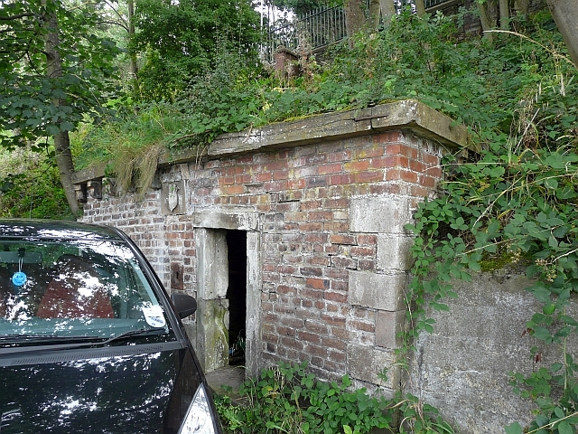
Image: © Rose and Trev Clough Taken: 28 Aug 2010
This strange little building, complete with escutcheon, survives in a bank below the road at Hall Brow, opposite the Police Station. It is built over a spring, and is said to be where the townspeople drew drinking water, until the first waterworks was built in the 1850s (Information : 'The History of Workington' by Richard Byers, 1998). On his website 'Old Workington', RW Barnes has photos of the well in 1986 http://www.users.globalnet.co.uk/~rwbarnes/workgton/friars.htm . There was a water spout in the shape of a man's face just outside the door - it is not there now.
Images are licensed for reuse under creativecommons.org/licenses/by-sa/2.0
Image Location
Latitude
54.644756
Longitude
-3.541378