Old building
Introduction
The photograph on this page of Old building by Thomas Nugent as part of the Geograph project.
The Geograph project started in 2005 with the aim of publishing, organising and preserving representative images for every square kilometre of Great Britain, Ireland and the Isle of Man.

There are currently over 7.5m images from over 14,400 individuals and you can help contribute to the project by visiting https://www.geograph.org.uk
Old building
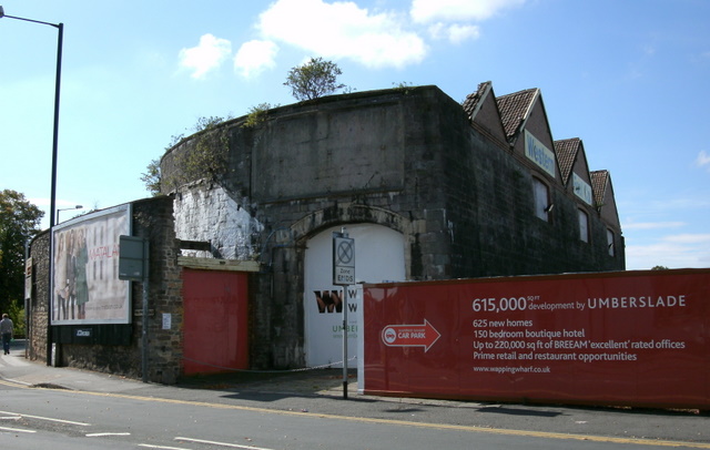
Image: © Thomas Nugent Taken: 28 Sep 2010
At the junction of Wapping Road and Cumberland Road. This old building is on the edge of the Wapping Wharf development site and appears to be being retained whilst many nearby have been demolished. See the date stone above the arched doorway here Image
Images are licensed for reuse under creativecommons.org/licenses/by-sa/2.0
Image Location


Leaflet Map data © OpenStreetMap
Latitude
51.446636
Longitude
-2.596968