Queen's Rock
Introduction
The photograph on this page of Queen's Rock by Derek Harper as part of the Geograph project.
The Geograph project started in 2005 with the aim of publishing, organising and preserving representative images for every square kilometre of Great Britain, Ireland and the Isle of Man.

There are currently over 7.5m images from over 14,400 individuals and you can help contribute to the project by visiting https://www.geograph.org.uk
Queen's Rock
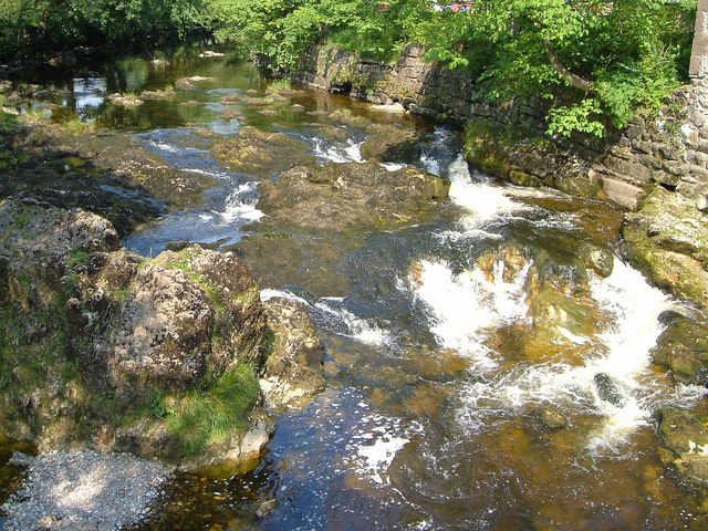
Image: © Derek Harper Taken: 29 Jun 2006
The River Ribble looking upstream from Giggleswick Memorial Bridge, with the river rushing over rocks after a placid stretch. Apparently this was once "King's Rock", according to http://www.archive.org/stream/churchwardensofg00brayiala/churchwardensofg00brayiala_djvu.txt (1884) , which also comments that it "is rapidly breaking up", so it was presumably more of a rock-like feature.
Images are licensed for reuse under creativecommons.org/licenses/by-sa/2.0
Image Location
Latitude
54.070784
Longitude
-2.285569