Biddulph Brook
Introduction
The photograph on this page of Biddulph Brook by Jonathan Kington as part of the Geograph project.
The Geograph project started in 2005 with the aim of publishing, organising and preserving representative images for every square kilometre of Great Britain, Ireland and the Isle of Man.

There are currently over 7.5m images from over 14,400 individuals and you can help contribute to the project by visiting https://www.geograph.org.uk
Biddulph Brook
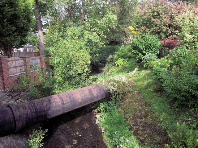
Image: © Jonathan Kington Taken: 22 Sep 2010
Looking down at Biddulph Brook from the bridge on Mow Lane, from here it will join the River Dane at Congleton. On some earlier maps, circa 1200 to 1500 AD, the brook is referred to as the River Dane Inshaw. The large steel pipe crossing the brook will probably be a gas main.
Images are licensed for reuse under creativecommons.org/licenses/by-sa/2.0
Image Location
Latitude
53.124446
Longitude
-2.171211